利用地形、土壤和作物信息辅助提高东北漫岗地数字高程模型精度的新方法
A New Method to Improve the Accuracy of Digital Elevation Model in Northeast China by Using Terrain, Soil and Crop Information
利用地形、土壤和作物信息辅助提高东北漫岗地数字高程模型精度的新方法 |
| 马雨阳,官海翔,杨昊轩,邵帅,邵逸群,刘焕军 |
|
A New Method to Improve the Accuracy of Digital Elevation Model in Northeast China by Using Terrain, Soil and Crop Information |
| MA YuYang,GUAN HaiXiang,YANG HaoXuan,SHAO Shuai,SHAO YiQun,LIU HuanJun |
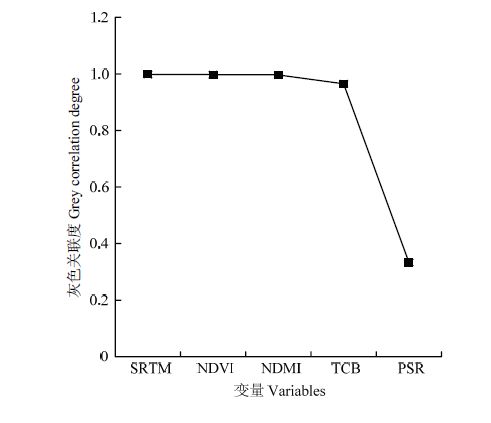
| 图6 输入变量与改进的SRTM DEM的关联度 |
| Fig. 6 The correlation between the input variable and the improved SRTM DEM |
|
|