利用地形、土壤和作物信息辅助提高东北漫岗地数字高程模型精度的新方法
A New Method to Improve the Accuracy of Digital Elevation Model in Northeast China by Using Terrain, Soil and Crop Information
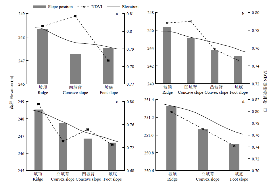
a:凹坡;b:先凹后凸复合坡;c:先凸后凹复合坡;d:凸坡
a: Concave slope; b: Compound slope with the first concave and then convex; c: Compound slope with the first convex and then concave; d: Convex slope