利用地形、土壤和作物信息辅助提高东北漫岗地数字高程模型精度的新方法
A New Method to Improve the Accuracy of Digital Elevation Model in Northeast China by Using Terrain, Soil and Crop Information
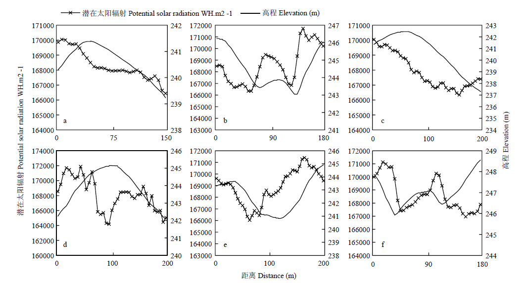
a、b、c、d、e、f分别代表
a, b, c, d, e, and f represent the six sections of figure 1, respectively. The same as