LAI无人机多光谱遥感估测及其在盐渍土改良中的应用
史丰智1,2,王瑞燕1,2( ),李玉环1,2,闫宏3,张晓鑫1
),李玉环1,2,闫宏3,张晓鑫1
LAI Estimation Based on Multi-Spectral Remote Sensing of UAV and Its Application in Saline Soil Improvement
FengZhi SHI1,2,RuiYan WANG1,2(),YuHuan LI1,2,Hong YAN3,XiaoXin ZHANG1
),YuHuan LI1,2,Hong YAN3,XiaoXin ZHANG1
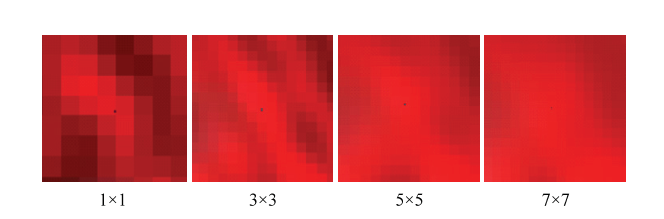
图5. 4种窗口滤波处理后的假彩色合成无人机影像(黑点为采样点)
Fig. 5. Four kinds of window filter processing false color synthesis UAV image (black spot is sampling point)