LAI无人机多光谱遥感估测及其在盐渍土改良中的应用
史丰智1,2,王瑞燕1,2( ),李玉环1,2,闫宏3,张晓鑫1
),李玉环1,2,闫宏3,张晓鑫1
LAI Estimation Based on Multi-Spectral Remote Sensing of UAV and Its Application in Saline Soil Improvement
FengZhi SHI1,2,RuiYan WANG1,2(),YuHuan LI1,2,Hong YAN3,XiaoXin ZHANG1
),YuHuan LI1,2,Hong YAN3,XiaoXin ZHANG1
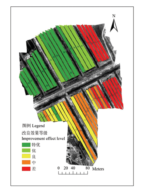
图4. 试验田改良效果等级划分图
Fig. 4. Experimental field improvement level classification map