基于高空间分辨率卫星影像的新疆阿拉尔市棉花与枣树分类
姬旭升1,2,3,4,李旭1,5,万泽福1,2,3,4,姚霞1,2,3,4,朱艳1,2,3,程涛1,2,3,4( )
)
)
Pixel-Based and Object-Oriented Classification of Jujube and Cotton Based on High Resolution Satellite Imagery over Alear, Xinjiang
JI XuSheng1,2,3,4,LI Xu1,5,WAN ZeFu1,2,3,4,YAO Xia1,2,3,4,ZHU Yan1,2,3,CHENG Tao1,2,3,4()
)
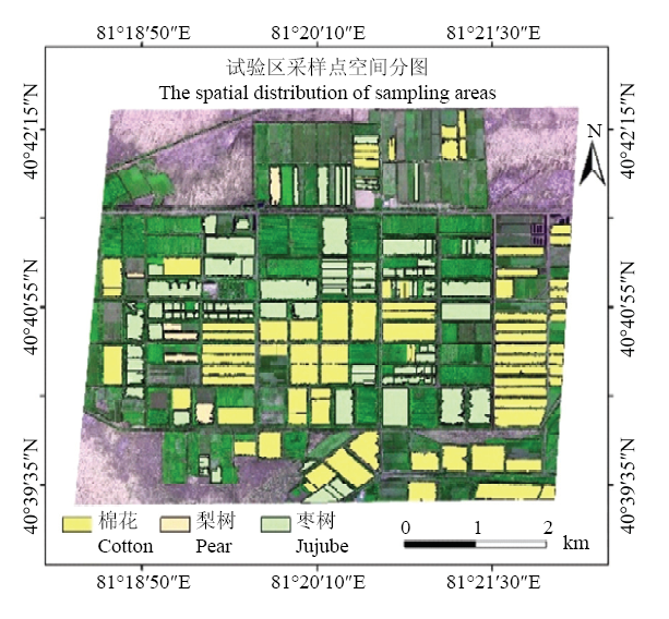
图2. 采样区空间分布
底图为研究区假彩色影像,R:Red;G:NIR;B:Green,矢量数据为采样区
Fig. 2. The spatial distribution of field samples
The base image iWWs a false color image of the study area, R: Red; G: NIR; B: Green, the vector data is the sampling area